City of seven islands: a place with no river, and the forty-five litres that divide it
Last revised July 2026. A long-read companion to the live dashboard and facts page. Dashboard - Facts
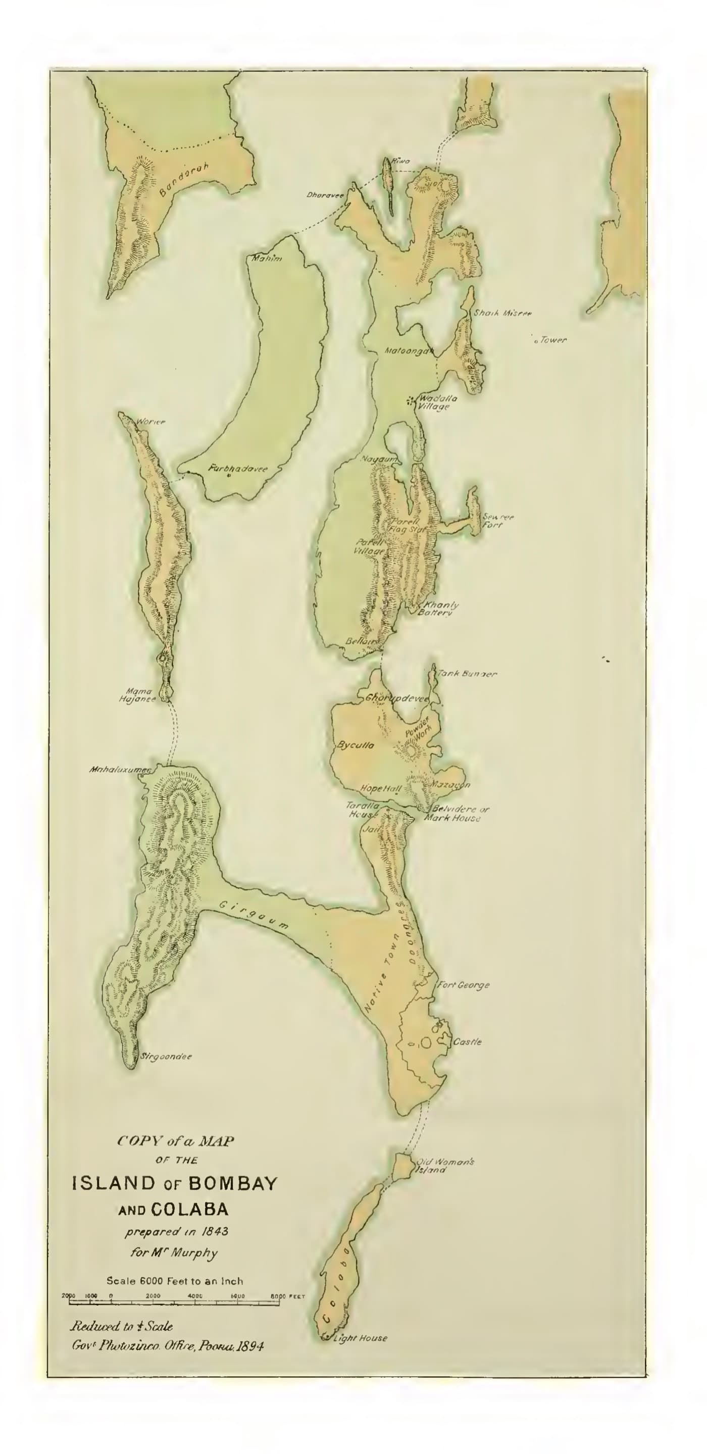
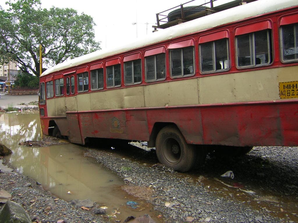
Mumbai was born without a river. The seven islands the Portuguese handed to the English in 1661 - Colaba, Old Woman's Island, Bombay, Mazagaon, Parel, Worli and Mahim - were low, brackish and sea-girt, and the only fresh water on them fell from the sky. So the islanders stored it: in talao (तळे), tanks cut into rock and lined with stone, and in vihir (विहीर), wells sunk to the thin freshwater lens beneath the basalt. Four centuries later the city drinks from seven lakes up to a hundred and thirty kilometres away, moves close to 3,850 million litres a day through its mains - and still cannot answer the oldest question a coastal settlement asks: who, on a thirsty island, gets the water first. Today the answer is measured in litres. A household in a notified slum receives about forty-five litres per person per day. A household a road away, in a non-slum building, receives about a hundred and thirty-five.
Talao: the water beneath the seven islands (to 1670)
A city with no river learned to store rain in stone - tanks and wells and one freshwater spring beside the sea - long before it had a single pipe.
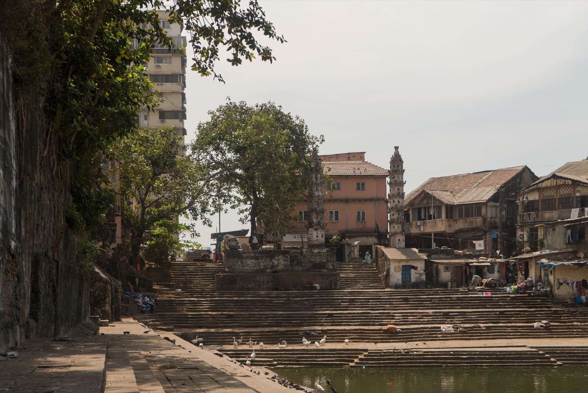
The original Mumbaikars were the Koli fisherfolk, whose gaothans (village cores) still sit, stubbornly, inside the glass city - Worli Koliwada, Khar Danda, Versova. Their water was the creek for the boats and the tank for the pot, and for centuries the two were kept rigorously apart. The most storied of those tanks is the Banganga (बाणगंगा) at Walkeshwar, on the southern tip - a rectangular stone talaofed by a freshwater spring that wells up within a few hundred metres of the Arabian Sea. Tradition ties it to the Silhara dynasty and a temple complex of the twelfth century; whatever its exact age, it is the proof of the islands' founding fact, that fresh water here was a point source to be guarded, not a flow to be taken for granted.
As the East India Company turned its swampy dowry into a trading town, it dug more of the same. Private philanthropy financed tanks the way it later financed hospitals: the Parsi merchant Framji Cowasji Banaji built a large tank near the Esplanade in the 1830s; Cowasji Patel, Gowalia, Babula and a dozen other named tanks pock the early maps. Stepwells - baodi (बावडी) in the regional vocabulary - and shallow wells did the daily work. It was a water system without a watershed: every drop was either caught where it fell or carried in. That worked while the town was small. It stopped working the moment the islands became one.
“The making of Bombay was the making of land - and the unmaking of the tidal water that had always defined it.”
The first pipe: the Vellard, Vihar, and the Sanitary Commissioner (1782-1900)
Joining the islands created a city too large for its tanks; cholera and a colonial Sanitary Commissioner brought the first pipe - and the first inequity built into it.
Between 1782 and 1784 Governor William Hornby drove a causeway, the Hornby Vellard, across the Worli breach where the sea poured in at high tide. It was an act of reclamation that fused the islands into a single landmass and made the modern city possible - and it bequeathed Mumbai its founding hydrological curse, a bowl of low-lying made land behind a sea wall, draining badly. The town that grew on it outran its tanks within two generations. Wells turned saline and foul; cholera arrived with the crowds. In 1845 the citizens petitioned for a proper supply, and the colonial state, which measured a port by its death rate, finally listened.
The answer came from the hills of Salsette to the north. The Vihar Waterworks, opened in 1860 under the eye of the Municipal Commissioner Arthur Crawford, dammed the headwaters of the Mithi at Vihar lake and piped the city its first impounded, gravity-fed water. Tulsi followed in 1879, Tansa in 1892 - the Tansa main, a hundred-odd kilometres of iron, one of the engineering marvels of Victorian India. For the well-to-do fort and the European quarter, water now arrived at the turn of a tap. For everyone else, it arrived at the pyaav (पाणपोई) - the ornate public drinking fountain, financed by the same merchant philanthropy that had built the tanks, dotting the streets so the labouring city could drink.
But a piped city is a city of choices about where the pipe goes, and those choices were made in a colonial grammar of worth. The fort, the cantonment and the European bungalows were plumbed first and fullest; the mill districts of Girangaon and the chawls that housed the workers who ran them came last, at lower pressure, for fewer hours. The inequality was not an accident of the network - it was the network. A map of who got water in 1900 and a map of who gets twenty-four-hour water in 2026 are, disquietingly, almost the same map.
“The fountain was charity made visible: the city could not yet give every street a pipe, so it gave the poor a place to cup their hands.”
Hydraulic citizenship: Modak Sagar to Middle Vaitarna (1957-2014)
As Mumbai reached deeper into the Western Ghats for water, a household connection became the proof that you were a citizen - and millions were left proving it.
The Salsette lakes could not slake a metropolis. So the city walked its intake into the Ghats, dam by dam: Modak Sagar on the Vaitarna in 1957, Upper Vaitarna in 1973, the vast Bhatsa - today nearly half of Mumbai's supply - impounded in stages through 1981, and finally Middle Vaitarna in 2014, the first new source in a generation. Each dam pushed the source farther from the tap and the tap farther from the people the dam displaced. The water now travelled a hundred kilometres and more to reach a city where, increasingly, the people who needed it most had no legal way to receive it.
For the millions arriving into Mumbai's settlements through the mill closures and the boom that followed, a water connection was never merely plumbing. It was recognition. To get a metered pipe you had to prove your settlement existed, which meant proving you existed - the right documents, the right cut-off date, the right councillor. The anthropologist Nikhil Anand gave this its name: hydraulic citizenship, the way Mumbai's poor bargain for belonging in the literal currency of water pressure, and the way the city's engineers and politicians dispense citizenship one valve at a time. Movements like SPARC, the National Slum Dwellers Federation and Mahila Milan turned that bargaining into method, enumerating themselves so the state could no longer say they were not there.
The same decades laid a darker pipe. Tens of thousands of families settled along the Tansa main itself - the very artery that carried the city its drinking water - in the only vacant land a poor migrant could find. The state would later decide that those people, sitting atop the pipe, were a security risk to the water inside it. Where to move them became a question the next chapter answers, in a place called Mahul.
“Water does not flow to those who need it, but to those who are able to make claims on the state - and pressure, in Mumbai, is both a hydraulic and a political fact.”
Foam, flood, and forty-five litres (2005-2026)
Three things broke into the open after 2005 - the flood the city had engineered, the buffers it kept selling, and the inequity it had piped in from the start.
On 26 July 2005 the Santacruz observatory recorded 944 millimetres of rain in twenty-four hours. The Mithi - the river the city had walled, narrowed and forgotten, the same river born at the Vihar and Powai overflows that gave Mumbai its first pipe - could not carry it, and rose into the bowl behind the Vellard. More than a thousand people died across the region. The Chitale Fact-Finding Committee, three volumes the following year, read like an indictment of the whole hydraulic history: the holding ponds built over, the storm drains designed for a colonial rainfall and never upgraded, the Mithi reduced to a sewer. Two decades on, the city has spent thousands of crores on the Mithi and on the BRIMSTOWAD drainage plan - and in 2025 the desilting contracts that were meant to keep it flowing became the subject of a money-laundering probe.
Mumbai's defences against the next deluge are the same wetlands it keeps converting. Salt pans and mangroves absorb the surge; in March 2025 the Supreme Court cleared roughly forty-five thousand mangroves for the Coastal Road's northern reach, and two hundred and fifty-six acres of public salt-pan land were earmarked for the Adani-led Dharavi redevelopment. The city floods, and then builds over the ground that would have drained it. iFLOWS-Mumbai, the integrated flood-warning model built with public money, briefs officials but not the public; the best open flood signal Mumbaikars have is a research radar network run out of the Indian Institute of Tropical Meteorology.
And beneath the flood runs the older inequity, now measured precisely. Praja Foundation's 2024 audit found that one ward in twenty-four gets twenty-four-hour water, that the citywide average is about five and a third hours a day, and that a metered slum household receives roughly forty-five litres per person against a hundred and thirty-five for a non-slum one. A peer-reviewed study put the gap between notified and non-notified slums at thirty-eight per cent even after accounting for income. When the tankers that fill the gap went on strike in April 2025, the city invoked the Disaster Management Act - the first known use of it for a water dispute. And the families once moved off the Tansa pipeline ended up in Mahul, a resettlement colony ringed by refineries that the National Green Tribunal had already declared, in 2015, unfit for human habitation.
The question the seven islands first asked - who, on a thirsty island, drinks first - is still the question. Mumbai has answered it with ever longer pipes and ever larger dams, the next one, Gargai, tendered in December 2025 to drown two thousand acres of forest and move six hundred families. But more water has never been the same thing as fairer water. The forty-five litres are not a supply problem. They are a citizenship problem - the same one the city has carried, unresolved, since the first pipe reached the fort and stopped.
“The water reaches the city. It is the citizen it does not always reach.”